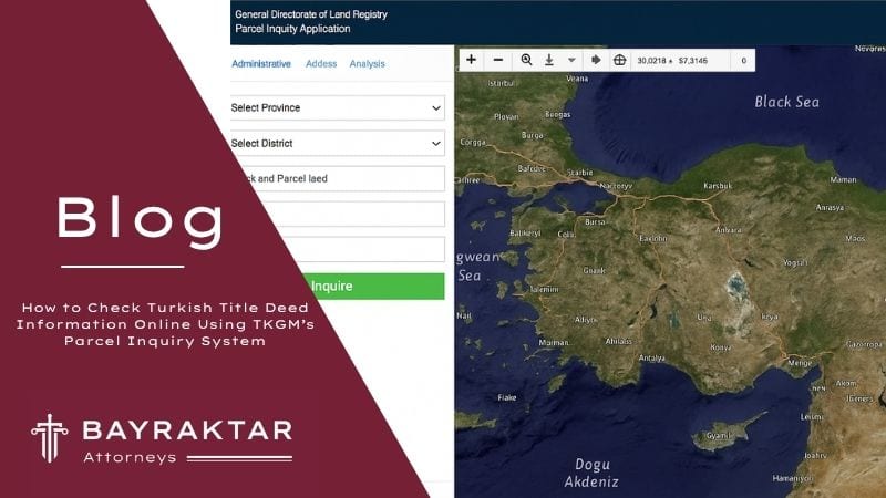
Quick answerThe TKGM parcel inquiry at parselsorgu.tkgm.gov.tr is open to everyone without login. Choose the province, district and neighbourhood, enter the ada (block) and parsel numbers, and the map shows the registered boundary, area, description and whether the parcel is under construction servitude or condominium ownership. It does not show the owner, mortgages, annotations or zoning: for those you need a land register extract and the municipality's zoning status certificate. Foreign buyers must also check military zones and the two year project rule in Article 35 of Law No. 2644.
Most foreign buyers in Türkiye first meet the TKGM parcel inquiry when an agent sends a listing with two numbers on it, an ada, the block number, and a parsel, the parcel number, and asks for a deposit before the viewing trip. The inquiry takes a minute and costs nothing, but it answers fewer questions than most buyers assume. It confirms that a parcel exists, where its registered boundaries lie and how the land register describes it; it does not tell you who owns it, what is registered against it or what may be built on it. The surrounding rules also moved in 2026: Law No. 7579, published in the Official Gazette on 22 May 2026, amended the Land Registry Law and the Cadastre Law, rewriting the procedure for correcting measurement errors and requiring banks and public bodies to send valuation reports to the land registry electronically, and at the end of September 2026 the land registry changed who may prepare the valuation report for citizenship purchases. This guide explains the inquiry step by step and then the records and checks that fill its gaps.
1. What the TKGM Parcel Inquiry Is
The parcel inquiry, Parsel Sorgu, is a public map application of the General Directorate of Land Registry and Cadastre, Tapu ve Kadastro Genel Müdürlüğü or TKGM, available at parselsorgu.tkgm.gov.tr. According to the application's official user guide, TKGM has offered basic parcel data through it to everyone, without restriction, since 2014. No registration, password or Turkish identity number is needed, the interface can be switched between Turkish and English, and the same service is published by TKGM as a mobile application called TKGM Parsel Sorgu.
The data comes from the cadastral maps and the land register, but the application is an information service. What it shows is a convenient extract, not a certified record, and it cannot be relied on against the land register itself. For technical questions the guide refers users to the TKGM call centre, ALO 181. The interface is updated from time to time, so button names may differ slightly from the description below, but the logic of the search has stayed the same.
2. Ada and Parsel Numbers: What They Are and Where to Find Them
2.1 What the Numbers Mean
Every registered piece of land in Türkiye is identified by its province, district and neighbourhood or village, followed by its block and parcel numbers. A block is a group of parcels bounded by roads, streams or other features on the cadastral or zoning map, and a parcel is a single plot inside that block, so "ada 1234, parsel 5" identifies one plot only within its neighbourhood. In many rural areas the cadastral work created no blocks, and those parcels have a parcel number only; the official guide tells users to leave the block field empty in that case.
A flat is not a separate parcel. It is an independent unit, bağımsız bölüm, registered on the parcel of the building, so the inquiry shows the building plot while the flat itself appears only in the land register. When you check an apartment, you are checking the land under the whole building.
2.2 Where to Find Them
The most reliable source is the title deed, tapu senedi, or better a current land register extract. In practice buyers find the numbers in these places:
- the seller's title deed or a photograph of it, which shows province, district, neighbourhood, map sheet, block, parcel, area and the description of the property;
- the owner's property tax records at the municipality, which identify the parcel;
- earlier sale contracts, building permits or occupancy permits for the building;
- the sales listing, although agents often give the wrong parcel or only an approximate location.
If a seller refuses to give the numbers before you pay anything, treat that as a warning sign. A genuine owner has no reason to hide the identity of a parcel that anyone can look up.
2.3 Map Sheet, Place Name and Property Identity Number
The result also lists the pafta, the map sheet number used in older cadastral records, and the mevkii, the local place name, both of which matter mainly in villages. Each property also has a Taşınmaz Kimlik Numarası, a property identity number used in TKGM systems, which is a quick way to confirm that two documents refer to the same record.
3. Step by Step: Running a Parcel Inquiry
3.1 Searching by Province, District, Neighbourhood, Block and Parcel
- Open parselsorgu.tkgm.gov.tr, accept the terms of use and, if you prefer, switch the language to English.
- In the administrative search tab, choose the province, the district and the neighbourhood or village from the menus.
- Enter the block number, or leave the field empty if the parcel has none, and then the parcel number.
- Press the search button. If a record exists, the parcel is highlighted on the map; click on it to open the attribute panel.
The neighbourhood names in the menu are those used in the land register, and the official guide warns that they can differ from current administrative units. This is a frequent cause of a "no record" result, for example where a former village has become a neighbourhood of a metropolitan municipality. Try the alternative name before concluding that the parcel does not exist.
3.2 Searching by Coordinates or Address
The geographic tab accepts latitude and longitude, which is useful for rural land where the seller has only sent a pin from a mapping app. Once the point appears, activate the information tool, the "i" button among the map tools, and click on the map to see the parcel under the point. The address tab relies on outside address services; it is convenient in cities, but the guide notes that it stops working when those services fail, and an address match is only as good as the address data. Always confirm the result by block and parcel.
3.3 Layers, Coordinates and Downloads
From the attribute panel you can list the corner coordinates of the parcel and the length of each boundary, switch the background between map, satellite and orthophoto layers, see when and by whom the orthophoto was produced, download the parcel geometry in KML, GeoJSON, Shape or DXF format, measure distances and areas, and share a link to the parcel. A KML file opens in Google Earth, which is a practical way to compare the registered boundary with what you saw on site. An analysis tab shows TKGM statistics on sales and mortgaged sales by province and district; this gives a general picture of market activity but says nothing about a particular parcel.
4. What the Parcel Inquiry Shows
The attribute panel contains the following fields. The Turkish names are given because they are also what you will see on deeds and correspondence.
| Field | What It Tells You |
|---|
| Taşınmaz Kimlik No | The property identity number in TKGM systems |
| İl, İlçe, Mahalle or Köy | Province, district and neighbourhood or village as recorded in the land register |
| Ada and Parsel | Block and parcel numbers identifying the plot |
| Tapu Alanı | The registered surface area in square metres, which can differ from the area on the ground |
| Nitelik | The description in the register, for example tarla (field), bahçe (garden), arsa (building plot) or a description of the building and its land |
| Mevkii and Pafta | Local place name and map sheet number, often empty in cities |
| Zemin tipi | Whether the parcel is a main property or is subject to construction servitude or condominium ownership |
| Bağlı detaylar | Linked spatial details where recorded, such as buildings, structures on the land or a mapped easement |
The ground type field, added in 2019, is useful for apartment buyers. Kat irtifakı, a construction servitude, allows units to be registered on the basis of an approved project before or during construction, while kat mülkiyeti, condominium ownership, is normally established once the building has its occupancy permit. A finished building that is still under construction servitude often means that no occupancy permit was obtained, which affects utilities, insurance and resale. Our article on floor easement and condominium ownership in Türkiye explains the difference in detail.
5. What the Parcel Inquiry Does Not Show
The gaps are where most problems hide. The inquiry does not show:
- the owner or owners, their shares, or whether the person selling to you is in fact registered as owner;
- mortgages, attachments by creditors or injunctions restricting a sale;
- annotations, şerh, such as a notarised promise to sell, a lease, a contractual pre-emption right or the three year no sale annotation of a citizenship purchase;
- declarations, beyan, such as a note that a building breaches zoning rules or a registered management plan;
- the zoning status, the permitted building ratios, the plan notes or a pending plan change;
- whether a building on the parcel has a building permit or an occupancy permit;
- the value of the property.
The reason is legal as well as practical. Under Article 1020 of the Turkish Civil Code, Law No. 4721, the land register is public, but its pages and documents are shown, or copies given, only to a person who makes a credible case of interest, and no one may claim to be unaware of an entry in it. The register itself, not the map application, decides who owns the land and what burdens it. Since a 2020 amendment to Article 32 of the Zoning Law, Law No. 3194, a municipality that finds a building in breach of zoning rules must notify the land registry within seven days so that the breach is recorded in the declarations section, which is one more entry you will only see in the register.
The registered area can also differ from the ground. Where an area or boundary is wrong because of measurement, drawing or calculation errors, Article 41 of the Cadastre Law, Law No. 3402, as rewritten by Law No. 7579 in 2026, lets the cadastre directorate correct differences that exceed the technical tolerance, either on application or of its own motion. The owners are notified of the correction and have 30 days to sue in the civil court of peace if they object; otherwise the correction becomes final. A buyer who notices a mismatch should raise it before the sale, not after.
6. Getting the Land Register Record
The document that answers the ownership and encumbrance questions is the land register record, tapu kaydı, often requested as a land register extract. There are three ways to see it.
6.1 From the Land Registry Office
Any land registry directorate can produce the record. An owner, or a lawyer acting under the owner's power of attorney, obtains it without difficulty. A prospective buyer is in a weaker position: a sales negotiation is not always accepted as a credible interest under Article 1020, so in practice the buyer asks the seller for a current extract, or the parties' lawyers exchange it. The extract should be dated within a few days of any payment, because a mortgage or an attachment can be registered at any time.
6.2 e-Devlet for Owners
On the e-Devlet portal, the TKGM service Tapu Bilgileri Sorgulama lists the properties registered to the person logged in, with share ratios and the entries recorded against them. Separate versions of the service cover property registered to your child, to a deceased person whose heir you are and to a legal entity you represent. A foreign owner who has a foreigner identification number and an e-Devlet password can use the same services. Two further services are worth knowing: Taşınmaz Yetkilendirme İşlemleri, through which an owner authorises an estate agent in respect of a property, and Tapu Telefon Bilgileri Beyan, through which an owner registers a mobile number with the land registry so that it can reach the owner about transactions on the property.
6.3 Web Tapu
Web Tapu, at webtapu.tkgm.gov.tr, is TKGM's online application platform. Owners log in through e-Devlet, and the platform has a separate entry for foreign users. Through it an owner can view the record of a property, including mortgages, attachments, declarations and easements, obtain a copy of the record, submit and follow applications for transactions and pay the fees. It has also been the channel through which valuation reports for transactions involving foreigners are ordered. Web Tapu shortens the preparation, but a sale is still concluded in official form before the land registrar.
7. Checking Zoning: İmar Durumu, e-İmar and e-Plan
The description field tells you how the register describes the land, not what the plan allows. A parcel registered as arsa may lie in a park area of the current plan, and a tarla may already be zoned for housing. Zoning is decided by the municipality within municipal and adjacent area boundaries and by the governorship outside them, and the official answer is the imar durum belgesi, the zoning status certificate.
The certificate states the plan in force, the designated use, the building ratios, height, setbacks and plan notes for the parcel. Under Article 55 of the Planned Areas Zoning Regulation, the owner or a representative applies with an application sketch and a land register copy, and the administration must issue the certificate within two working days. A buyer who is not yet the owner can usually obtain the same information informally from the municipality's zoning department or its online system, but the formal certificate is normally requested by the owner.
Many municipalities run an online zoning query, usually called e-İmar, where you select the parcel and see the plan and plan notes; Istanbul Metropolitan Municipality offers a parcel based plan viewer called İBB E-Plan. At national level, the Ministry of Environment, Urbanisation and Climate Change operates the e-Plan system, which shows plans in force and plans on public display and, since early 2025, notifies parcel owners through e-Devlet when a plan change concerns their parcel, with the option to object through the same channel. These tools are reliable for a first reading, but before paying for land, and always before planning a building, obtain the certificate itself. Our article on building a house on land in Türkiye explains what the certificate means for a construction project.
8. Checks a Foreign Buyer Should Run Before Paying
8.1 Military and Security Zones
Under the Military Forbidden Zones and Security Zones Law, Law No. 2565, land in first degree military forbidden zones is expropriated, foreign individuals and companies may not acquire immovable property in second degree land military forbidden zones (Article 9), and the President may close other strategic areas to foreigners and order the liquidation of property already held there (Articles 28 and 29). Article 35 of the Land Registry Law, Law No. 2644, links these rules to the register: the Ministry of National Defence and the Ministry of Interior supply the maps and coordinates of military forbidden, military security, strategic and special security zones, and land registry transactions are carried out on the basis of that data.
For an individual foreign buyer there is no separate military permission to apply for. The land registry checks the parcel against the zone data when the sale application is made. For years each file was sent to the military command for an opinion, which could add weeks; TKGM has since recorded the zone data in the register for most districts, so the check is usually made without that correspondence, although files in some districts may still be referred. If the parcel lies in a closed zone, the sale to a foreigner is refused, so the time to ask is before the deposit. Companies established in Türkiye with majority foreign capital are treated differently: under Article 36 of Law No. 2644, their acquisitions in military zones need the permission of the General Staff or the commands it authorises, and in special security zones the permission of the governorship.
8.2 Area Limits and Undeveloped Land
Article 35 caps the land a foreign national may hold at 30 hectares per person across Türkiye, a figure the President may double, and at 10 percent of the privately owned area of the district. A buyer of yapısız taşınmaz, land without a building, must also submit the project to be developed on it to the relevant ministry for approval within two years. The approved project is recorded in the declarations section, and land for which no application is made in time, or whose project is not carried out in time, is liquidated and its proceeds paid to the owner if the owner does not sell it within a period of up to one year set by the Ministry of Treasury and Finance. Anyone buying a field or an empty plot should plan the project from the start.
8.3 Shares and Hisseli Tapu
A hisseli tapu, a title to a share in a parcel, gives you an undivided fraction of the whole parcel, not a particular corner of it. Under Article 688 of the Civil Code, co-owners each own a share of a whole that is not physically divided, and each share can be sold, pledged or attached. The fence the seller shows you is not part of your title.
Two further rules matter. When a co-owner sells to an outsider, the other co-owners have a statutory pre-emption right under Article 732. Since Law No. 7571 of 24 December 2025, that right lapses three months after the sale is notified to them through a notary and in any event one year after the sale, instead of the previous two years, and a co-owner who exercises it must deposit the market value fixed by the judge rather than the price you paid. In addition, any co-owner may ask the court to end the co-ownership under Article 698, which under Article 699 leads to a division in kind or, where that is not suitable, to a sale of the whole parcel at public auction. Our article on joint ownership and hisseli tapu covers the rights of co-owners in more depth.
8.4 Agricultural Land
Land described as tarla, bahçe or similar is usually agricultural land under the Soil Conservation and Land Use Law, Law No. 5403. Article 8 provides that the minimum agricultural parcel size may not be set below 2 hectares for absolute, marginal and special crop land, 0.5 hectares for land under perennial crops such as orchards and 0.3 hectares for greenhouse land, and that agricultural land may not be divided, or its number of shares increased, below the sizes set by the Ministry. Since a 2020 amendment, Article 8/B also makes subdivision, share transfers and the conversion of joint ownership into shares on agricultural land subject to the permission of the Ministry of Agriculture and Forestry. A foreign individual who wants to acquire agricultural land needs the Ministry's permission under its 2012 instruction based on Article 35, and must have an agricultural project approved by the provincial directorate within two years. Building on such land is a separate question, governed by its own permission regime.
8.5 A Valuation Report for Citizenship Purchases
If the purchase is meant to support an application for citizenship by investment, the property itself must qualify. Under Article 20 of the Regulation on the Implementation of the Turkish Citizenship Law, as amended in 2022 and 2023, the property must be worth at least 400,000 US dollars or the equivalent in foreign currency, must be a unit under condominium ownership or construction servitude or a building plot with a building on it, and a three year no sale annotation must be placed on the title. An empty field or an undeveloped plot therefore does not qualify, whatever its price.
The value is proven by a valuation report, not by the price in the contract. Under TKGM Circular 2024/2, as amended at the end of September 2026, the report used for citizenship may be prepared by any valuation firm licensed by the Capital Markets Board that is an active member of the Association of Valuation Experts and connected to TKGM's TADEBİS valuation system. A report below the threshold means the purchase will not support the application, so order it before you commit. Our note on the latest change to citizenship valuation reports explains what changed in practice.
9. Practical Errors We See
9.1 The Wrong Parcel
The most common error is checking the wrong plot. Agents copy numbers from older documents, the neighbourhood has been renamed, or the listing gives the parcel next door because it has the better view. When a zoning plan is implemented, old parcels are often merged and redistributed under new block and parcel numbers, so a deed a few years old may describe a parcel that no longer exists in that form. Compare the coordinates, shape and area in the inquiry with what you were shown on site, and make sure the numbers in the contract and in the land registry application match the current extract.
9.2 Buying the Field Instead of the Title
In rural and coastal areas land is still sold by pointing at a piece of ground. The seller walks the buyer to a fenced or marked area, the buyer pays for that area, and the title transferred is a share of a much larger parcel. The buyer later discovers that the plot has no registered boundary, that other co-owners use the same land, or that a partition action puts the whole parcel up for auction. An informal agreement among co-owners about who uses which part does not change the register and may not bind later co-owners. Under Articles 705 and 706 of the Civil Code, ownership of land is acquired by registration and a contract to transfer land is valid only in official form, so a sale contract signed in an office or a receipt for a deposit does not make you an owner.
9.3 Trusting the Description and the Screenshot
Other recurring mistakes are treating a "villa plot" registered as tarla as building land, relying on a screenshot of the inquiry sent by the seller instead of running it yourself, assuming that a building visible on the satellite layer is licensed, and paying a deposit before seeing a current land register extract. Each of these takes minutes to avoid and can cost the whole purchase price if ignored.
10. From Parcel Inquiry to Title Transfer
Once the parcel, the register, the zoning and the checks that apply to foreign buyers are clear, the sale itself takes place at the land registry. The parties, or their attorneys, sign the official deed before the land registrar, the fees are paid and ownership passes on registration. Under Article 63 of the Fees Law, Law No. 492, the title deed fee is calculated on the declared price, which may not be lower than the property tax value, and declaring less than the real price exposes the parties to a supplementary assessment and a tax loss penalty. You can estimate the fee with our title deed fee calculator. The full procedure, including appointments, documents and the order of payments, is set out in our guide to the title deed and property title transfer in Türkiye, and the meaning of the entries you will find in an extract is explained in our article on annotations and declarations in title deeds.
11. Frequently Asked Questions
11.1 Does the TKGM parcel inquiry cost anything?
No. It is open to everyone at parselsorgu.tkgm.gov.tr and in the TKGM Parsel Sorgu mobile app, without registration or payment.
11.2 Can I see who owns a parcel on parselsorgu.tkgm.gov.tr?
No. Ownership appears only in the land register; owners see it on e-Devlet or Web Tapu, and others need a credible interest under Article 1020 of the Civil Code.
11.3 What do ada and parsel mean?
Ada is the block number and parsel is the parcel number; together with the province, district and neighbourhood they identify one plot.
11.4 Why does the inquiry return no result for my parcel?
Usually because the neighbourhood is listed under its land register name, a block number was entered for a parcel that has none, or the parcel was renumbered after a zoning implementation.
11.5 Does the parcel inquiry show mortgages or annotations?
No. Mortgages, attachments, annotations and declarations appear only in the land register record.
11.6 Can I check zoning with the parcel inquiry?
No. The description field is not the zoning status; use the municipality's zoning status certificate, its e-İmar system or the Ministry's e-Plan.
11.7 Is the area shown in the inquiry final?
It is the registered area. Errors beyond the technical tolerance can be corrected under Article 41 of Law No. 3402, and owners have 30 days from notification to challenge a correction in court.
11.8 Can a foreigner use e-Devlet and Web Tapu?
Yes, a foreign owner with a foreigner identification number and an e-Devlet password can use the TKGM services, and Web Tapu has a separate entry for foreign users.
11.9 How can I tell whether a building has condominium ownership?
The ground type field shows whether the parcel is under construction servitude or condominium ownership; the land register extract confirms it for each unit.
11.10 Can a foreigner buy property near a military zone?
Not inside a closed military or strategic zone. The land registry checks the parcel against the zone data supplied under Article 35 of Law No. 2644 and refuses a sale that falls inside one.
11.11 Can a foreigner buy agricultural land in Türkiye?
Yes, within the 30 hectare and 10 percent limits, with the permission of the Ministry of Agriculture and Forestry and an agricultural project approved within two years.
11.12 If I buy a share of a field, can I build on my part?
No. A share is an undivided fraction of the whole parcel, and building needs a permit that requires the consent of all co-owners and land that may be built on.
11.13 Does a field or an empty plot qualify for citizenship?
No. Since the December 2023 amendment, only units under condominium ownership or construction servitude, or building plots with a building on them, qualify.
11.14 Who can prepare the valuation report for a citizenship purchase?
Under TKGM Circular 2024/2 as amended in September 2026, any valuation firm licensed by the Capital Markets Board that is an active member of the Association of Valuation Experts and connected to TADEBİS.
11.15 What should I check before paying a deposit?
Run the parcel inquiry yourself, obtain a land register extract dated within days, read the zoning certificate and confirm the foreign buyer restrictions and, if relevant, the citizenship valuation.
12. Conclusion
The TKGM parcel inquiry is the right first step and a poor last one. Within a minute it tells you whether the block and parcel numbers you were given exist, where the registered boundaries lie, how large the parcel is, how the register describes it and whether it is under construction servitude or condominium ownership. It does not tell you who owns the land, what is registered against it, what may be built on it or whether a foreigner may buy it. Those answers come from the land register extract, the municipality's zoning certificate, the restrictions in Articles 35 and 36 of the Land Registry Law and, for citizenship buyers, a qualifying valuation report.
If you have been sent parcel numbers and asked for a deposit, send us the numbers, the listing and any documents before you pay. We can obtain and read the register, check zoning and the restrictions that apply to foreign buyers, and handle the transfer through our real property sales and title deed transfer service; for any question about a specific parcel, our legal team can review the documents and advise you before you commit.